UPDATE: THIS RIDE IS OVER, BUT WE’LL BE POSTING MORE RIDES SOON. You can find a brief ride summary and some photos on Steve’s Strava activity:https://www.strava.com/activities/12916865605
Expect a normal “three speeds” ride on SUNDAY 11/24. We’ll try to get that ride posted soon.
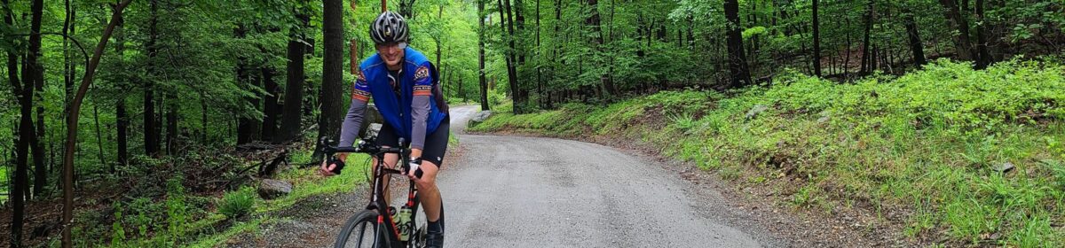
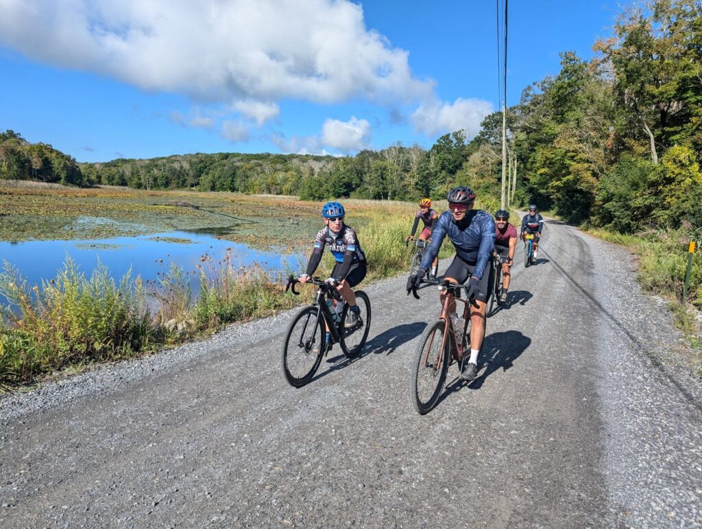
This week (Saturday 11/16) Steve will be leading an informal gravel ride aimed at folks in our faster pace group. Expect miles of fun off-road trails and crazy climbs. If you have the choice between skinnier and fatter tires, bring the fat tires. You’ll be okay on normal gravel tires (e.g. 40mm) if that’s what you’ve got.
DISCLAIMER: This is totally informal. You ride at your own risk and are responsible for your own safety. You are expected to be self-sufficient. We cannot guarantee the condition or safety of roads and trails. Nor can we control the behavior of other riders. This is not a supported event. We expect everyone to be an experienced cyclist who can repair a flat, carry appropriate food and hydration, and navigate independently if they lose the group.
UPDATE: THIS RIDE IS OVER, BUT WE’LL BE POSTING MORE RIDES SOON. You can find a brief ride summary and some photos on Steve’s Strava activity: https://www.strava.com/activities/12862424903
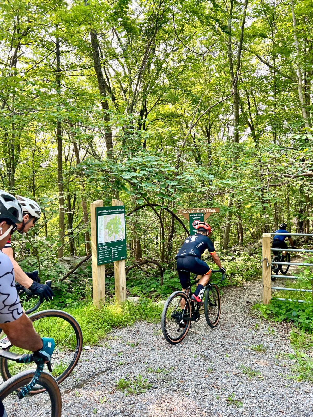
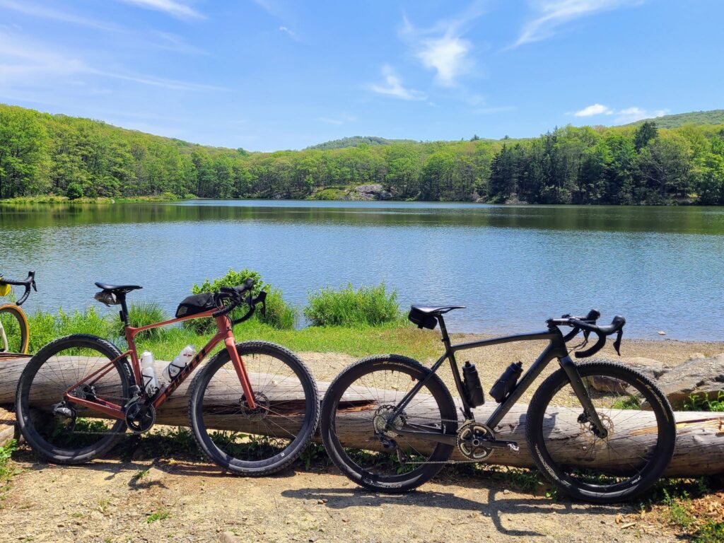
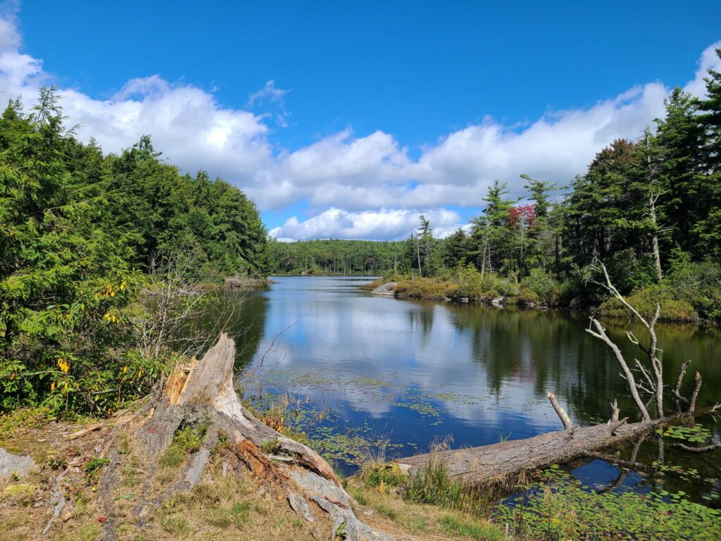
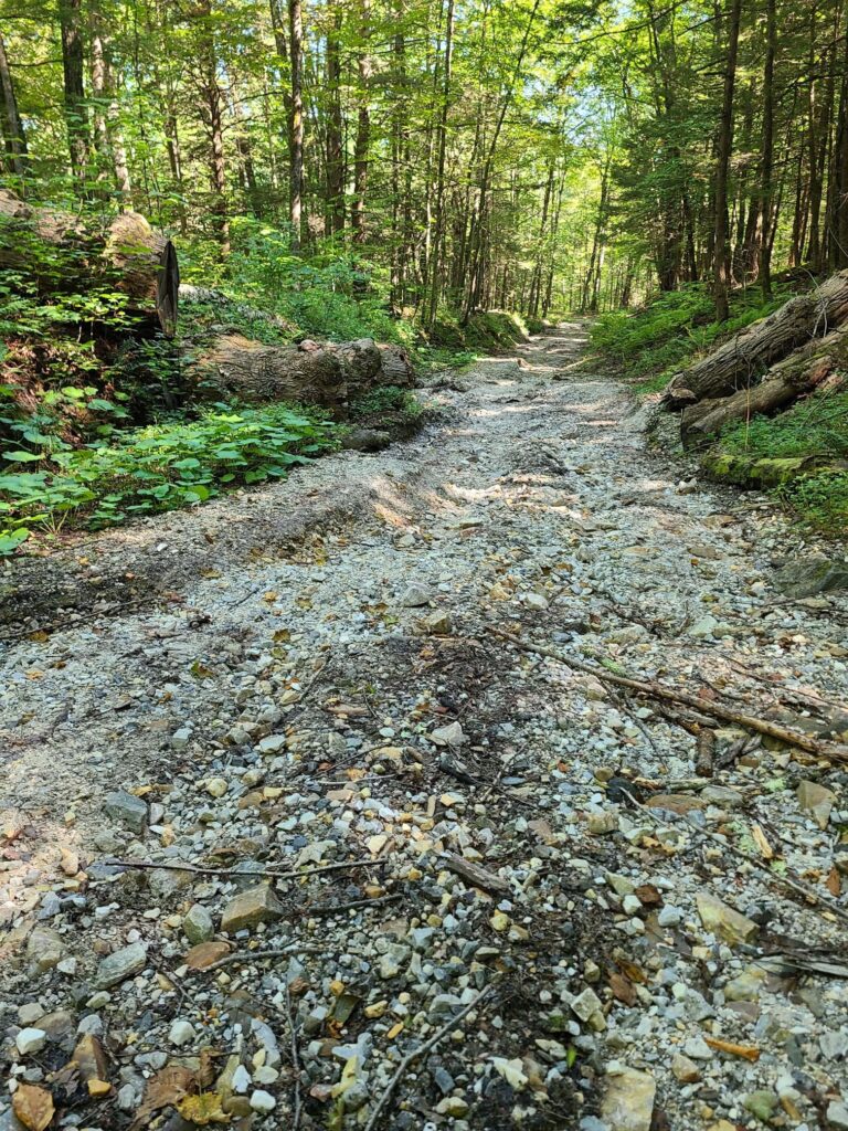
Come ready for adventure! Black Rock Forest is a hidden gem in our region. Steve has visited across seasons, whether riding the forest roads, hiking the trails, XC skiing, or snowshoeing. We will stick to the maintained forest roads, which were highly rideable – and a lot of fun – when we scouted them in July. It’s a beautiful place!
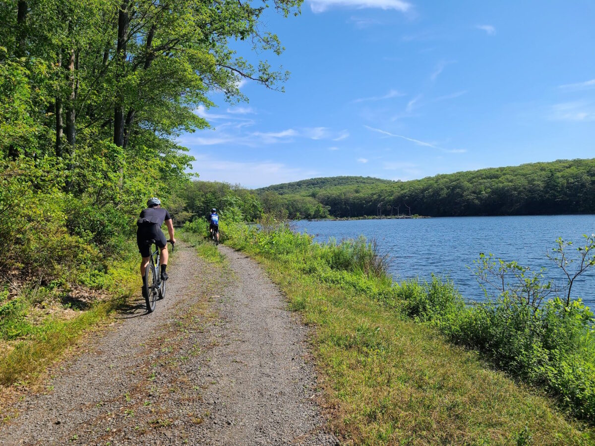
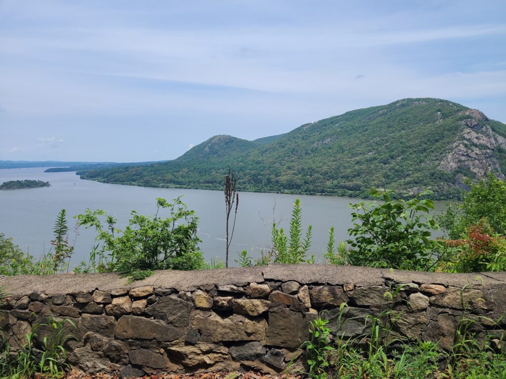
We’ll also visit Storm King Highway, a better-known highlight of our region, which offers magnificent views of the Hudson River and beyond. Black Rock Forest and Storm King both suffered major damage during a major storm in July of 2023. Thankfully both places have been repaired, so we can return to these favorite spots.
*** We will start at Bear Mountain State Park. If you are driving, there is a $10 fee for parking. If you have a NYS Empire Pass, you’ll be able to park for free, just like in any other NYS park.
*** Train riders can hop off at Manitou Station. They will have a 3-mile ride to Bear Mountain. [There is no parking lot at Manitou Station. If drivers want to avoid the parking fee at Bear Mountain, you’ll have to find a different place.]
*** All riders should use caution at the start and end of the route! We’ll have to navigate a busy road and traffic circle as we leave Bear Mountain State Park. The same goes for train riders, who will have to navigate to the park.
Strava is currently stripping external links from their pages. We have posted the routes and map links below.
QUESTIONS? You can email Steve at track.smart@gmail.com, but first see the RSVP link on Strava and GrNY’s tips and guidelines page, which contain a lot of useful information.
END OF RIDE HANGOUT: Informal picnic at Bear Mountain. See the RidewithGPS routes for the exact location we plan to gather after the ride. Look for the picnic table symbol on the map.
DISCLAIMER: This is totally informal. You ride at your own risk and are responsible for your own safety. You are expected to be self-sufficient. We cannot guarantee the condition or safety of roads and trails. Nor can we control the behavior of other riders. This is not a supported event. We expect everyone to be an experienced cyclist who can repair a flat, carry appropriate food and hydration, and navigate independently if they lose the group.
UPDATE: THIS RIDE IS OVER, BUT WE’LL BE POSTING MORE RIDES SOON. You can find a brief ride summary and some photos on Steve’s Strava activity: https://www.strava.com/activities/12806981854
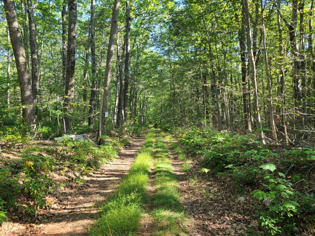
This area of NJ has some of the nicest gravel riding in our region: Dirt roads through woods, forests, and along peaceful streams; Ridges and hills with beautiful pastoral views; Quaint small towns with General Stores. You’ll probably find at least one cooler in the woods with local maple syrup and an on-your-honor jar for depositing money.
Strava is currently stripping external links from their pages. We have posted the missing links below.
QUESTIONS? You can email Steve at track.smart@gmail.com, but first see the RSVP link on Strava and GrNY’s tips and guidelines page, which contain a lot of useful information.
START LOCATION: Natirar Park. Take the Peapack Rd entrance and go to the first parking area: https://goo.gl/maps/Naqdh1oga6mN5FRS8. Check the RWGPS routes for clarification.
END OF RIDE HANGOUT: Picnic in Natirar Park. We’ll bring some cold drinks and snacks.
DISCLAIMER: This is totally informal. You ride at your own risk and are responsible for your own safety. You are expected to be self-sufficient. We cannot guarantee the condition or safety of roads and trails. Nor can we control the behavior of other riders. This is not a supported event. We expect everyone to be an experienced cyclist who can repair a flat, carry appropriate food and hydration, and navigate independently if they lose the group.
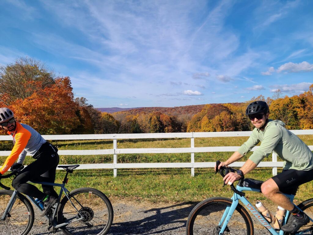
In honor of Kathy’s birthday, join us for a challenging ride on the dirt roads and trails of Litchfield County, CT. We’ll be riding brand new routes for the occasion. Expect tunnels, forests, and potentially goats on the trail!
Start Location: Pawling Train Station – https://maps.app.goo.gl/qDnPvgnn4ruwdYYZ8 (* Be sure to look at the RWGPS routes for the exact meet-up location and parking spot for car drivers)
DISCLAIMER: This is totally informal. You ride at your own risk and are responsible for your own safety. You are expected to be self-sufficient. We cannot guarantee the condition or safety of roads and trails. Nor can we control the behavior of other riders. This is not a supported event. We expect everyone to be an experienced cyclist who can repair a flat, carry appropriate food and hydration, and navigate independently if they lose the group.
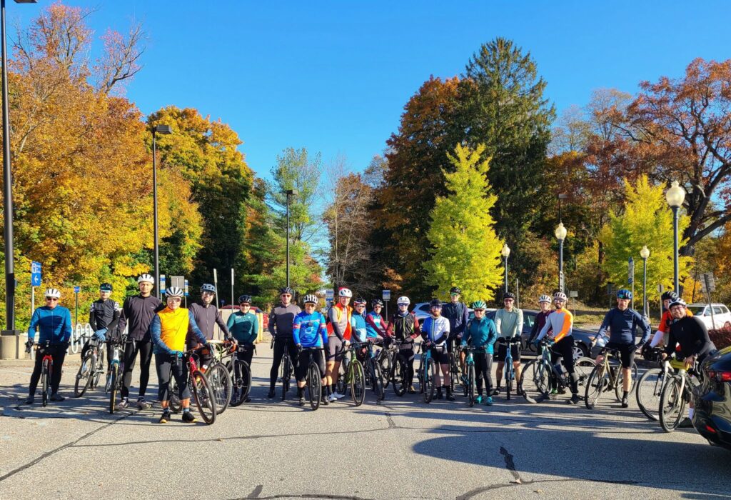
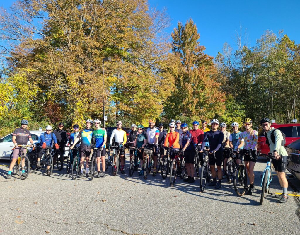
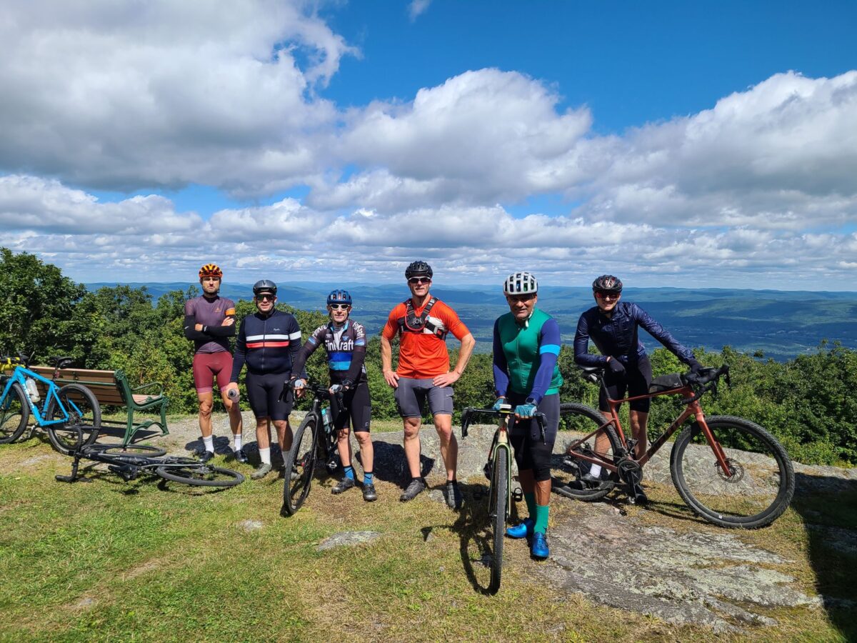
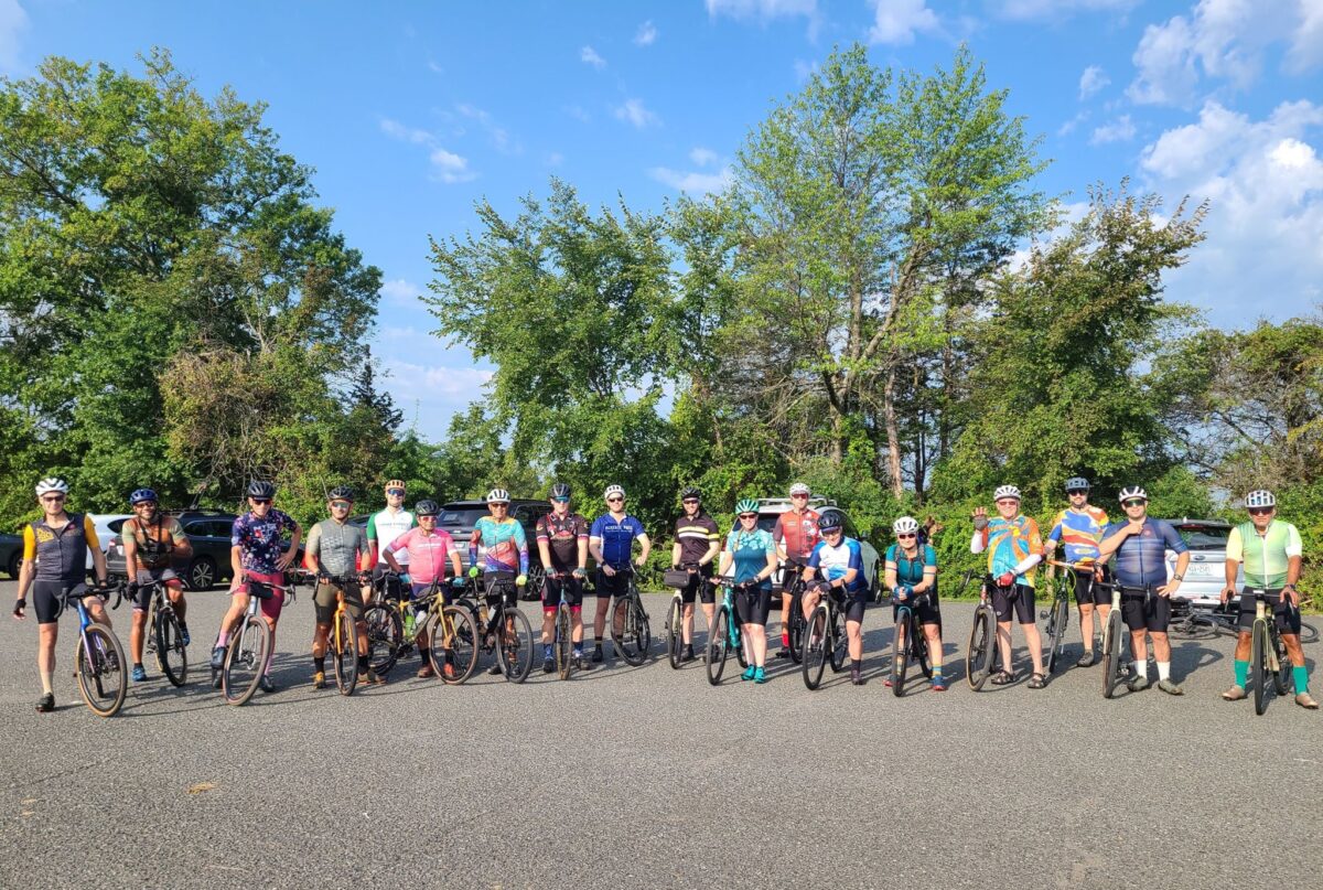
Group photo, minus about seven riders who were still getting ready near their cars.
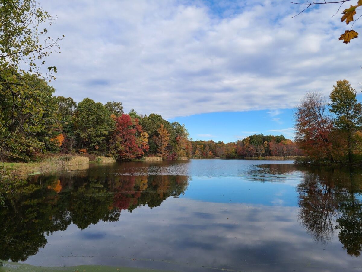
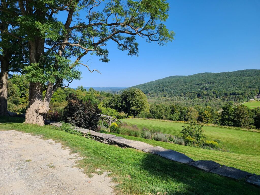
Great views. There was still some excellent fall foliage in many places.
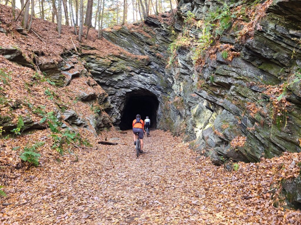
Riders entering the tunnel in Steep Rock Preserve.
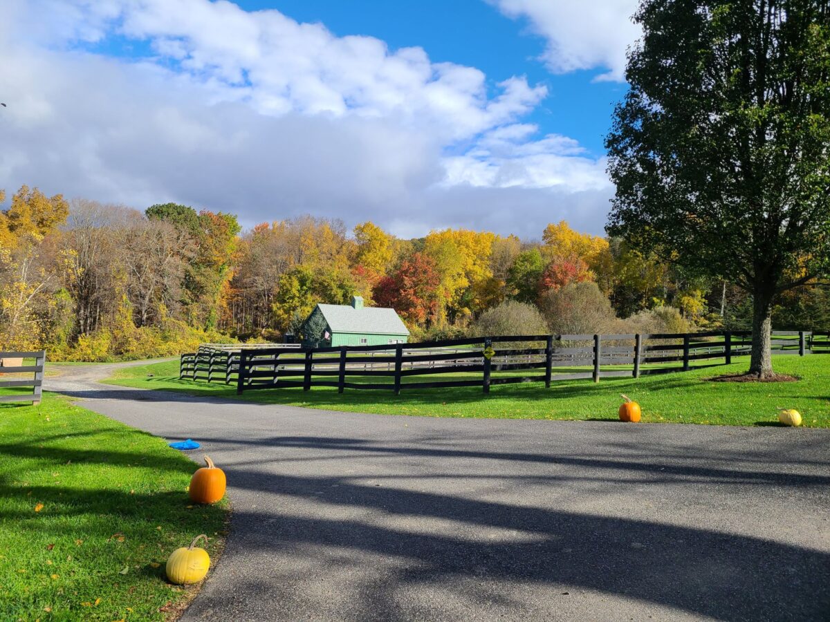
Join us for a spectacular fall foliage ride on the dirt roads of Dutchess County. We’ll be riding fresh routes to keep things interesting! The trees should have nice fall color, which will be an extra treat. We will have the usual three pace groups (short, medium, long) and expect all groups to end at around the same time. All routes end at Kelly’s Creamery & Food Truck, so everyone can celebrate together at the end of the ride.
Strava is currently stripping external links from their pages. We have posted the links related to this group ride below.
Start Location: Dover Plains Train Station. Use the parking lot on Market Street. Do NOT use the parking lot on Railroad street. Google maps link: https://maps.app.goo.gl/eJeZb2fB9N2L6ber7
DISCLAIMER: This is totally informal. You ride at your own risk and are responsible for your own safety. You are expected to be self-sufficient. We cannot guarantee the condition or safety of roads and trails. Nor can we control the behavior of other riders. This is not a supported event. We expect everyone to be an experienced cyclist who can repair a flat, carry appropriate food and hydration, and navigate independently if they lose the group.
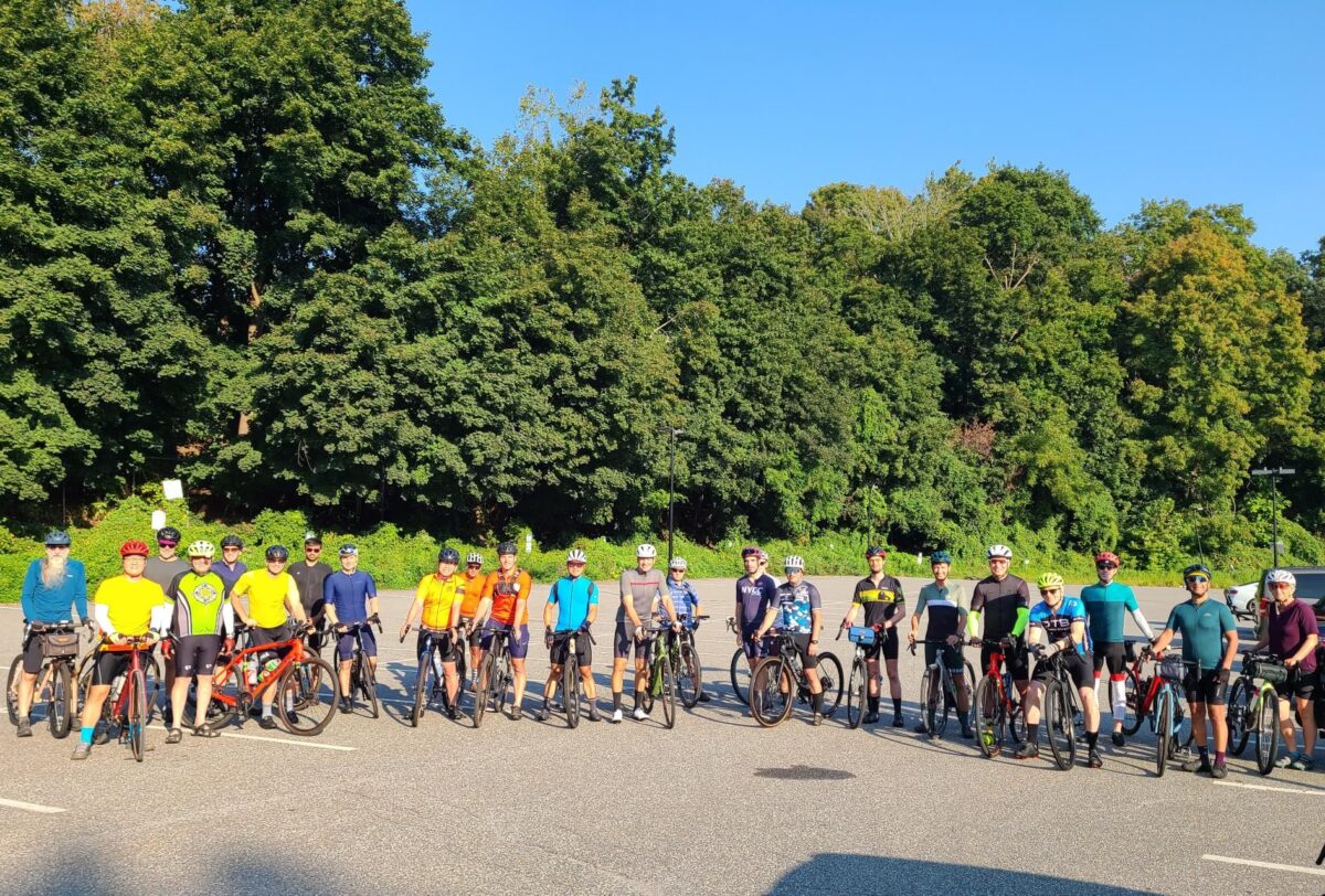
Group photo, minus 5 riders who were either late or still getting themselves ready to roll.
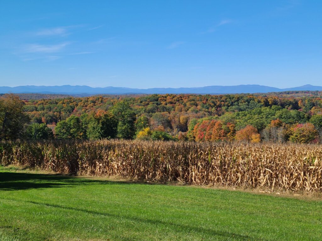
View from the top of Tower Hill Rd. Absolutely worth the climb! Fall colors in the foreground and the Catskills Mountains in the distance.
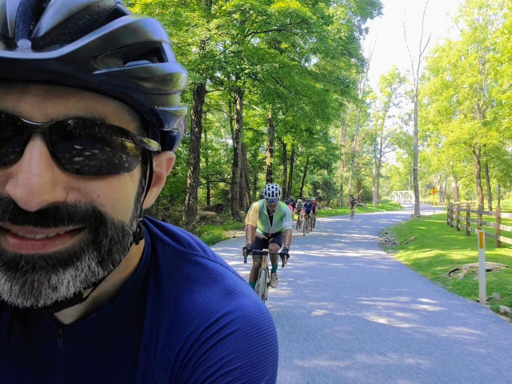
Summer weather returned for this weekend, so we decided to get the band back together for another three-speeds ride! It was a lovely ride on beautiful rolling roads in Westchester. We traversed forests, reservoirs, and horse country estates. This was a bit of a “groad” ride (more pavement and less dirt), but it allowed us to visit some places we seldom travel in our other Westchester rides. The long, medium, and short distance groups all had plenty of riders and everyone had a great time. Many of us gathered at Paulie’s Deli after the ride for some well-deserved drinks and food. Thanks to everyone who joined us today and added to the fun!
Spectacular day of riding with some GrNY regulars. We had perfect weather and a beautiful course! This ride included the core of the Berkshires-Riga-Sunset Rock route, but we started in Wingdale, NY, which is closer to NYC. The route includes an optional spur (mile 50, in blue) to the top of Mt Everett. Everyone was feeling good and did the extra climb, though not everyone maintained traction for the steepest section near the end (i.e., a few riders needed to walk a short distance). The road up to Mt Everett is steep, particularly the last 0.5 mile dirt section near the top, but there are good views as payoff.
We were originally targeting Sunday for this ride, but Saturday’s upcoming rain was going to make that a bad idea. Instead, a couple of us took Thursday off and we queued up a different Berkshires century ride for Sunday!
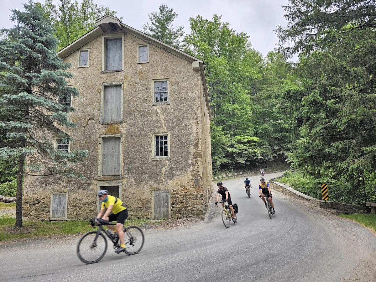
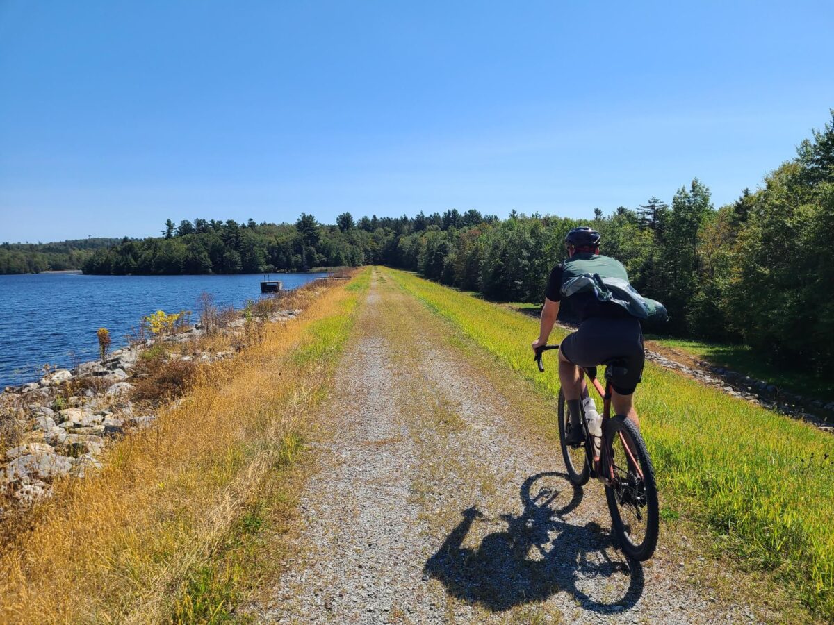
This route (October Mtn) was a gorgeous mix of deep woods, open vistas, smooth dirt, rough dirt, and some double-track and jeep-road adventure mixed in. About 85 miles was new exploration for GrNY, including the lovely October Mountain area. Note that conditions will change greatly if the weather has been wet recently (i.e., expect deep puddles, mud, and stream-bed-like sections), so choose your timing for this route accordingly! We chose a period of dry weather. Also consider whether to bring larger tires for the rougher sections. Steve was on 40mm gravel tires, but he would have appreciated fatter tires in places. Please use caution on the rougher parts, particularly the descents.
The route travels from North Canaan, CT to October Mountain State Forest in Massachusetts and includes all of the dirt from F2G2 (Fall Foliage Gravel Grinder) and a lot more. Expect ~65% dirt roads by distance, but probably 75% dirt by riding time.
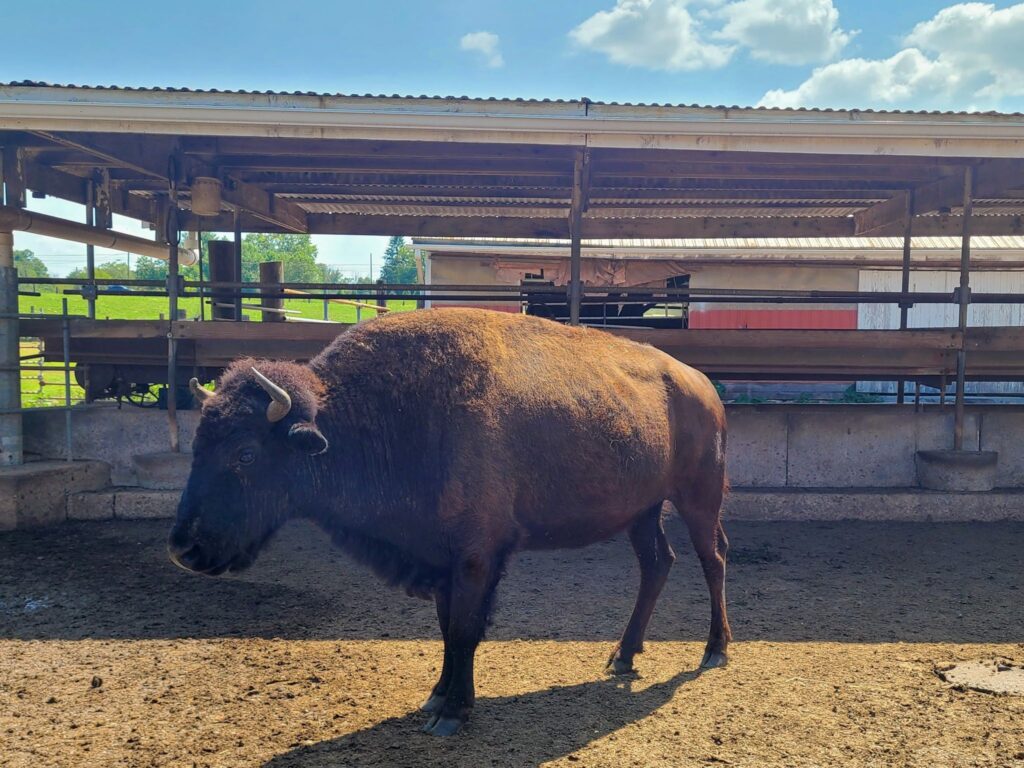
Awesome day on the bike in NJ. Our thanks to David S. for cooking up some great new routes for us! And a second thanks, for being our personal guide (for the Long Distance group) with interesting facts, real-time hazard warnings, local history, and making sure we got up-close and personal with the Buffalo in Readington! All three pace groups (short/medium/long) arrived back at Burnt Mills Park at about the same time (just a few minutes apart). Everyone rode hard, enjoyed the excellent scenery, and most people stayed after the ride for cold drinks and homemade baked goods courtesy of Kathy. Thanks everyone for making it a fun day!
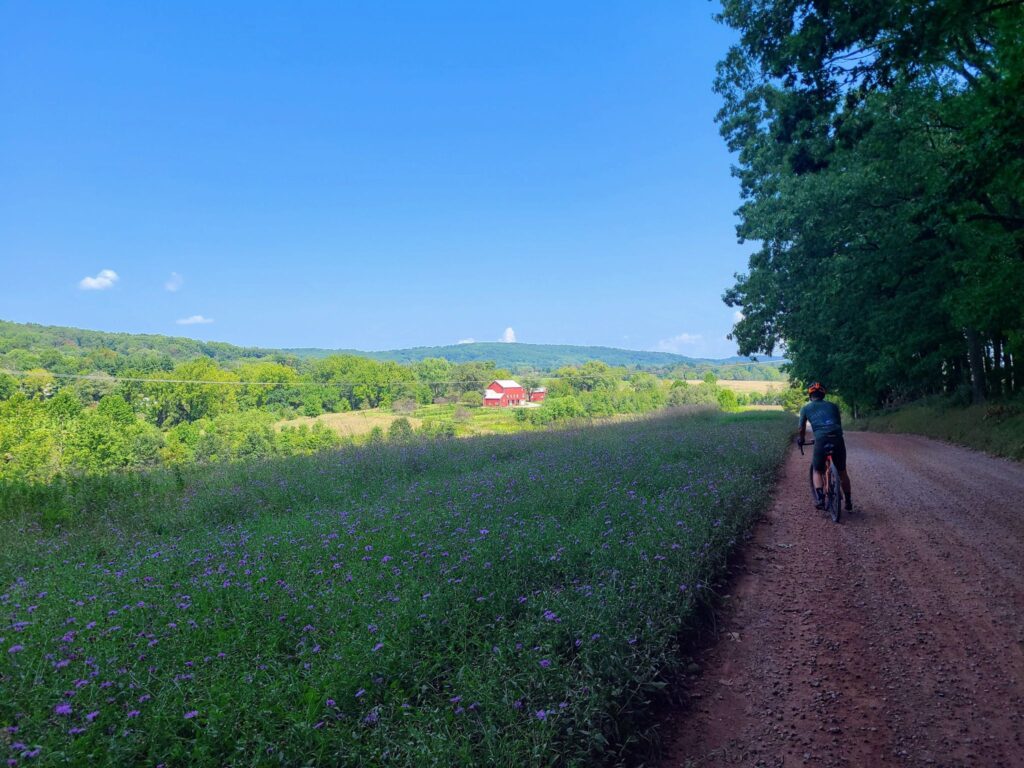
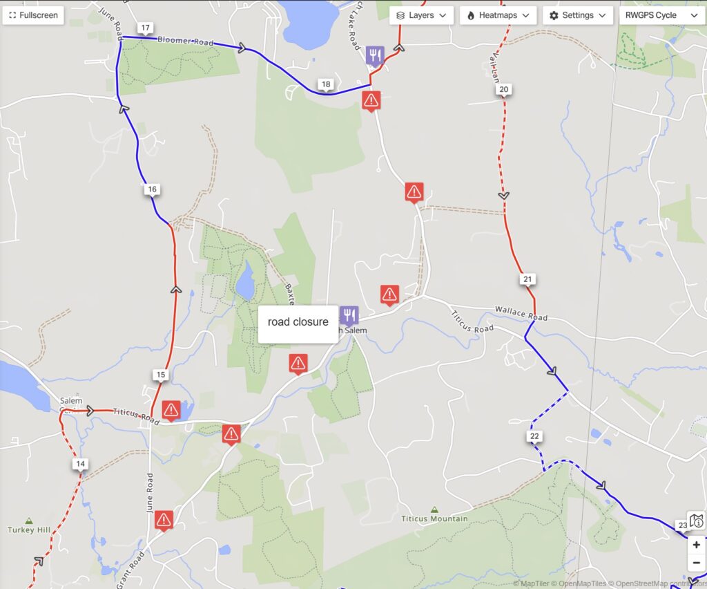
Super fun and chill gravel century with a few GrNY riders. It’s been two years since we attempted the “full version” (100+ miles) of our “All the Dirt Roads in Westchester” ride. It was time for a revisit on this beautiful day! Some extra detours were required this time, due to the road construction in the northern part of our ride near North Salem, but we managed to get just about all of the dirt, none-the-less.
For those who don’t need to be quite as completionist, the 88-mile version of this route has a slightly higher proportion of dirt and fewer random out-and-back spurs: https://ridewithgps.com/routes/44840039 [Warning: At this moment, you won’t be able to ride the route above due to construction in the northern part! See what we did in Steve’s Strava post for how to get around the construction and still catch most of the dirt in the north.]
The 88-miler is probably, in objective terms, a better route, but there’s something fun about the madness of trying to get ALL OF THE DIRT in one ride! Yes, there are a few bits of dirt road further away in southern Westchester, etc, but you need to draw the line somewhere. At some point you want the ride to be heavily biased towards dirt, rather than 75% pavement and 130+ miles of total distance, just to squeeze in a couple of miles of missing dirt roads.
[* All of the reasonably connectable dirt roads, so >95% of the total. We ignored forest trails and multi-use paths. We were shooting for actual dirt roads. We also avoided private property and a few, short dead-end streets that are practically driveways.]
Routes (BEWARE OF CONSTRUCTION CLOSURES NEAR NORTH SALEM. YOU’LL NEED TO MAKE DETOURS UNTIL THAT IS DONE)