UPDATE: THIS RIDE IS OVER, BUT WE’LL BE POSTING MORE RIDES SOON. You can find a brief ride summary and some photos on Steve’s Strava activity:
https://www.strava.com/activities/12862424903
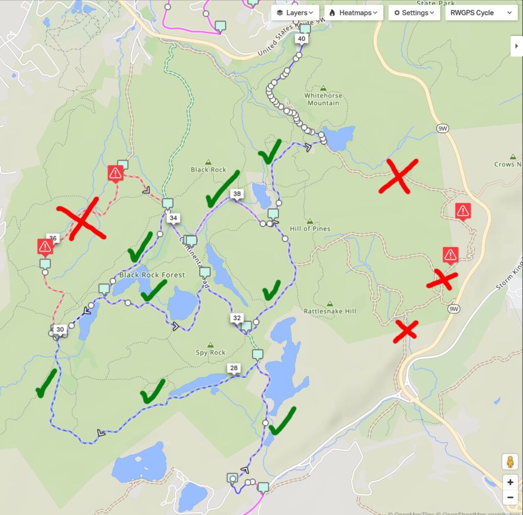
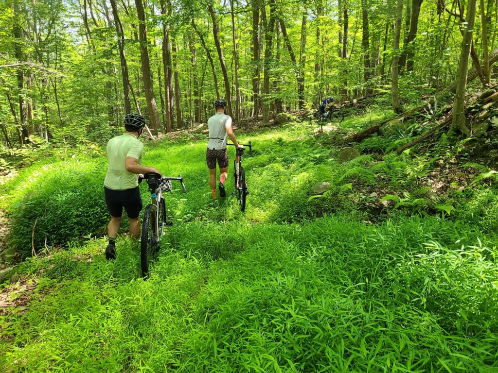
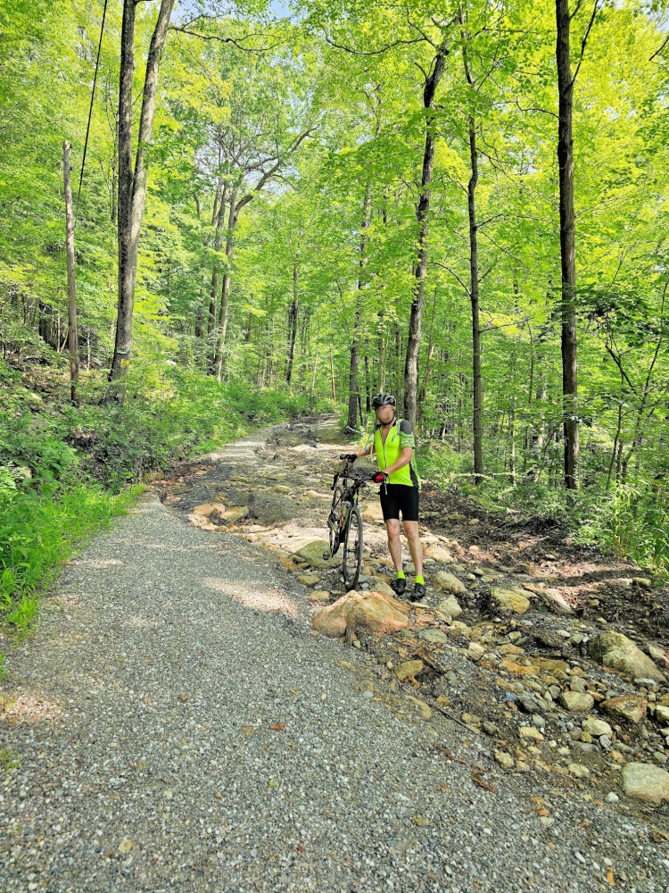
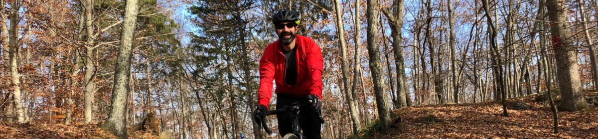
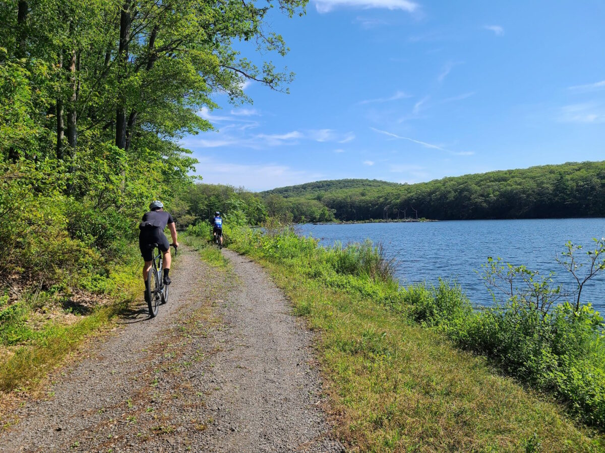
Come ready for adventure! Black Rock Forest is a hidden gem in our region. Steve has visited across seasons, whether riding the forest roads, hiking the trails, XC skiing, or snowshoeing. We will stick to the maintained forest roads, which were highly rideable – and a lot of fun – when we scouted them in July. It’s a beautiful place!
Here are some photos from Black Rock Forest for inspiration: https://photos.app.goo.gl/XzXA1TRMH7emrGWe6
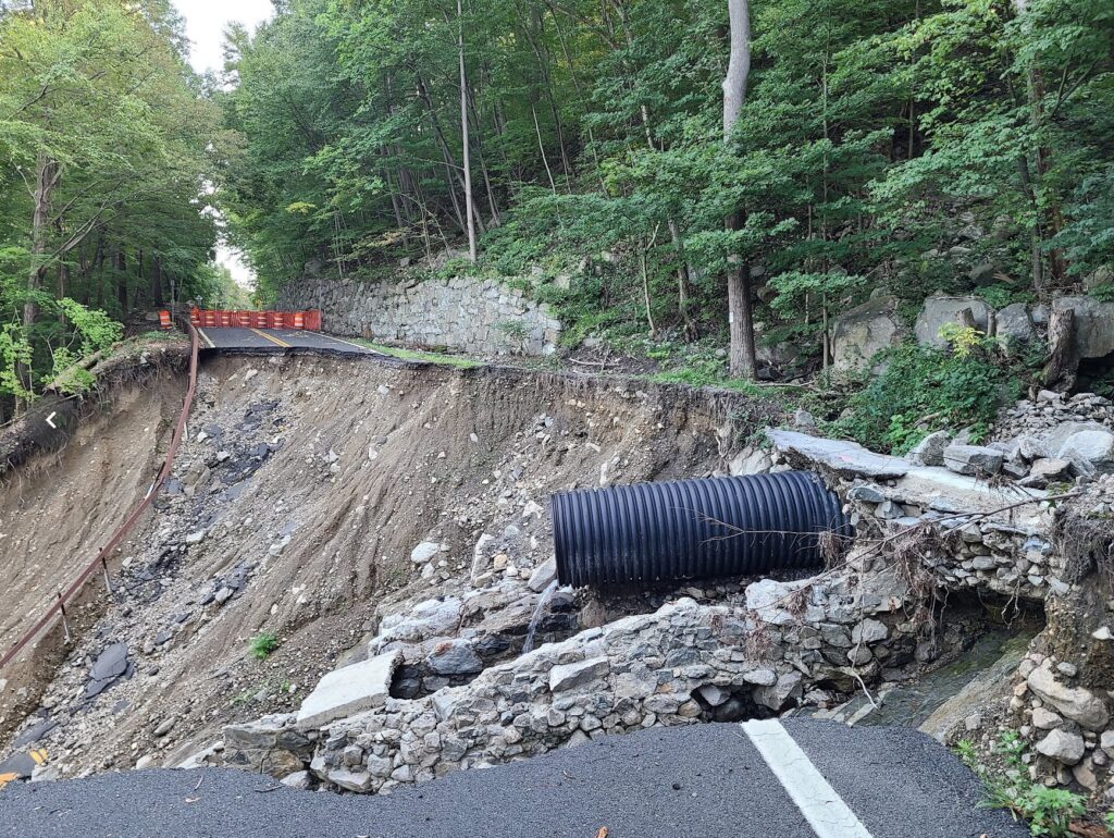
We’ll also visit Storm King Highway, a better-known highlight of our region, which offers magnificent views of the Hudson River and beyond. Black Rock Forest and Storm King both suffered major damage during a major storm in July of 2023. Thankfully both places have been repaired, so we can return to these favorite spots.
See Strava to RSVP and find more details about the ride and pace groups: https://www.strava.com/clubs/513005/group_events/1829665
*** We will start at Bear Mountain State Park. If you are driving, there is a $10 fee for parking. If you have a NYS Empire Pass, you’ll be able to park for free, just like in any other NYS park.
*** Train riders can hop off at Manitou Station. They will have a 3-mile ride to Bear Mountain. [There is no parking lot at Manitou Station. If drivers want to avoid the parking fee at Bear Mountain, you’ll have to find a different place.]
*** All riders should use caution at the start and end of the route! We’ll have to navigate a busy road and traffic circle as we leave Bear Mountain State Park. The same goes for train riders, who will have to navigate to the park.
Strava is currently stripping external links from their pages. We have posted the routes and map links below.
QUESTIONS? You can email Steve at track.smart@gmail.com, but first see the RSVP link on Strava and GrNY’s tips and guidelines page, which contain a lot of useful information.
ROUTES:
Long (60mi, ~6000ft): https://ridewithgps.com/routes/48960396
Medium (48mi, ~4500ft): https://ridewithgps.com/routes/48913132
Short (38mi, ~3500ft): https://ridewithgps.com/routes/48913108
START LOCATION: Bear Mountain State Park, Parking Lot 1. Map link: https://maps.app.goo.gl/ScbZTf7v6w96iwyZ8
END OF RIDE HANGOUT: Informal picnic at Bear Mountain. See the RidewithGPS routes for the exact location we plan to gather after the ride. Look for the picnic table symbol on the map.
DISCLAIMER: This is totally informal. You ride at your own risk and are responsible for your own safety. You are expected to be self-sufficient. We cannot guarantee the condition or safety of roads and trails. Nor can we control the behavior of other riders. This is not a supported event. We expect everyone to be an experienced cyclist who can repair a flat, carry appropriate food and hydration, and navigate independently if they lose the group.
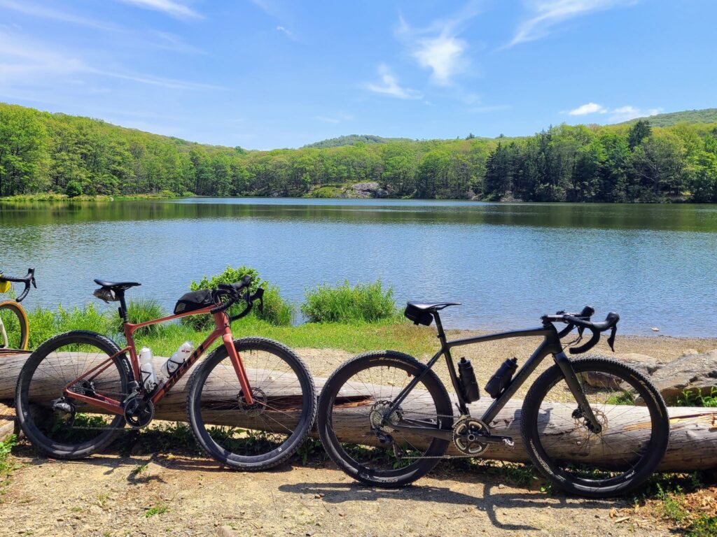
Black Rock Forest.
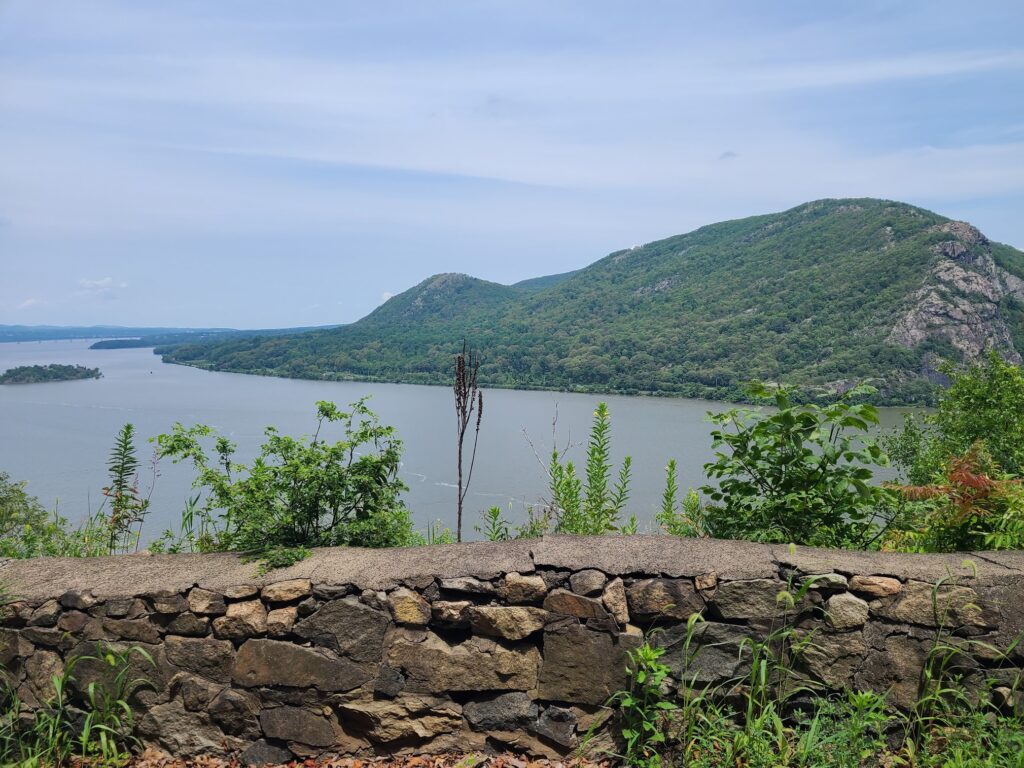
Views from Storm King Highway.