Areas north of NYC experienced torrential rains during a mid-July storm (2023). It’s already mid-September, but some roads and trails have not yet been repaired. Be extra careful if you plan to ride in these areas, below.
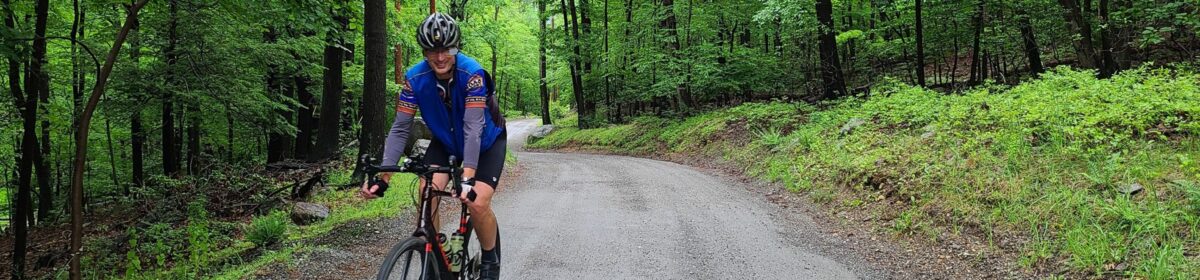
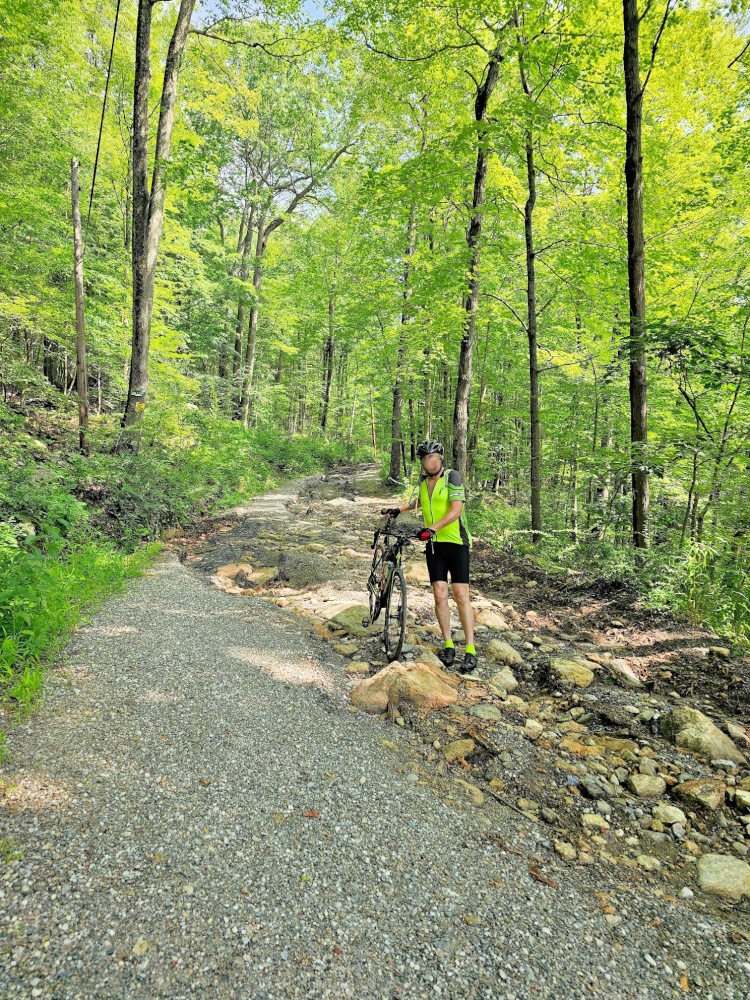
Parts of Sunken Mine Rd, in Puntam County, NY were destroyed during the aforementioned storm. I’ve heard from a few groups of riders who found this out the hard way. In one case, a rider went down pretty hard as they approached the destruction. Even on the “better” parts, I’ve heard that the road/trail is pretty rough and there are many downed branches. The photo above the post, with the rider in yellow, is of Sunken Mine Rd. It was taken by Ken shortly after the July storm. Thanks Ken!
NOTE: Many of the dirt roads in Putnam County are in rougher shape than usual. On our last ride, we encountered many more washouts, big potholes, or soft spots (where riders lost traction) than usual. Old Albany Post Rd is one example of a great dirt road, which is rideable, but extra caution is required – particularly when going downhill, where speeds will be high. We purposly routed uphill only for most of our time on that road, with one short exception, which you could consider cutting around by staying on Rt 9 in that direction.
Black Rock Forest is a beautiful place to ride. That said, it should be avoided by bike until the roads and trails can be repaired (consider a hike instead). The trails and some of the other infrastructure at this research forest were badly damaged in that July storm. I think some of that damage will take a long time to repair. Note: bikes are only allowed on the roads / jeep roads — see their trail maps. Currently, trails are open for hiking but they state: “Please exercise extreme caution on trails and roads, and especially stream crossings!”. Has anybody been to Black Rock Forest recently and ridden on the bike-allowed trails? It would be great to understand current conditions.
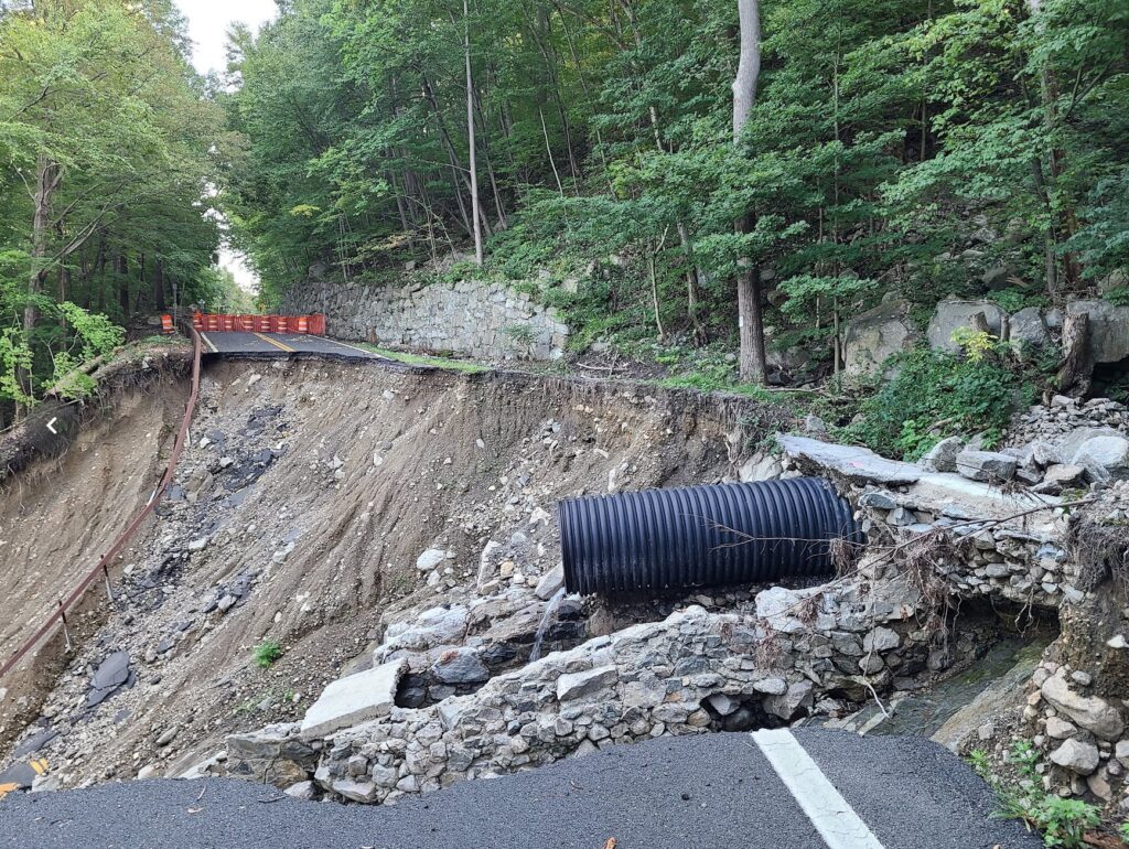
Storm King Highway still has a section that was washed into the Hudson River. Yes, this is a paved road, but it is also the main way to travel through that area, on a bike, without riding on the side of the highway (9W) with an intermittenly disappearing shoulder (the shoulder turns into a drainage culvert in places), which I do not recommend. You will *not* be able to walk around that destroyed part. One section of the rear slope is a sheer rock face with water running down it, like a waterfall that is ready to carry you down the cliff.
Know about other damaged dirt roads we should watch out for? Let us know! email: track.smart@gmail.com. In particular, we tend to ride in these areas, which are within striking distance of NYC: Westchester, Putnam, Orange, and Dutchess Counties in NY; Litchfield County in CT; and the Bedminster region in NJ. Thanks!
The photo below is the state of Storm King Highway as of recently (September 2023). I’m not going to provide a photo credit since you aren’t supposed to visit that spot. The waterfall-like section is not visible in the photo, but please understand that you will not be walking around this mess. You will be stuck on one side or the other.